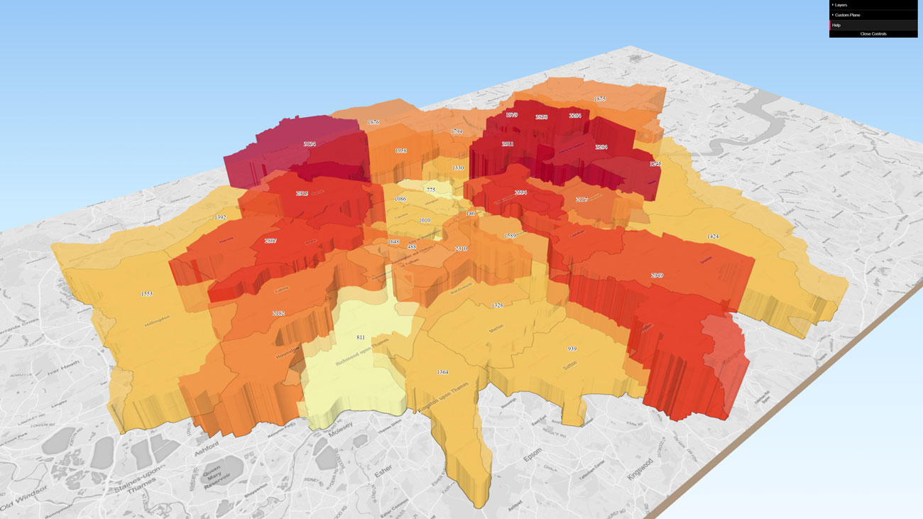
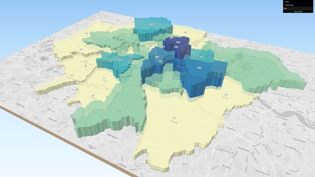
We created interactive 3D maps of the New Draft London Plan housing targets and compared this with the 2015 targets
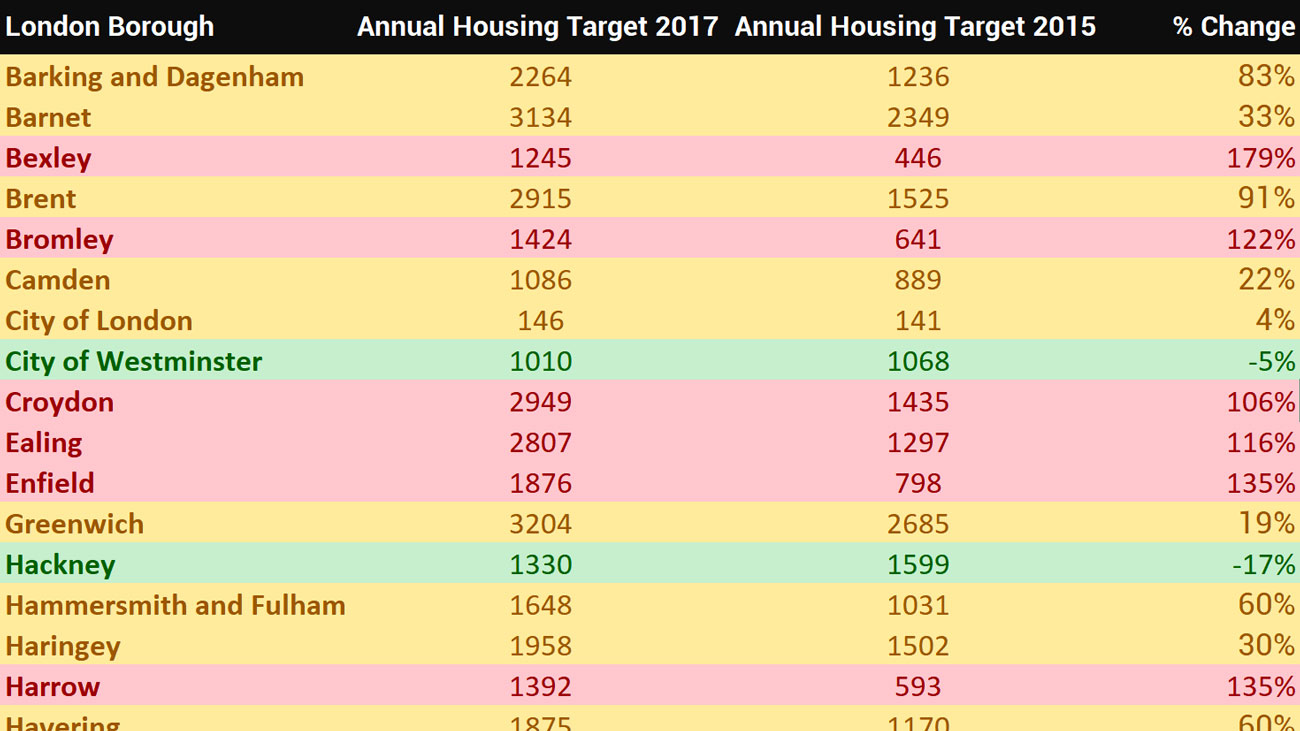
London Plan Borough Housing Targets 2017
London Plan Borough Housing Targets 2015
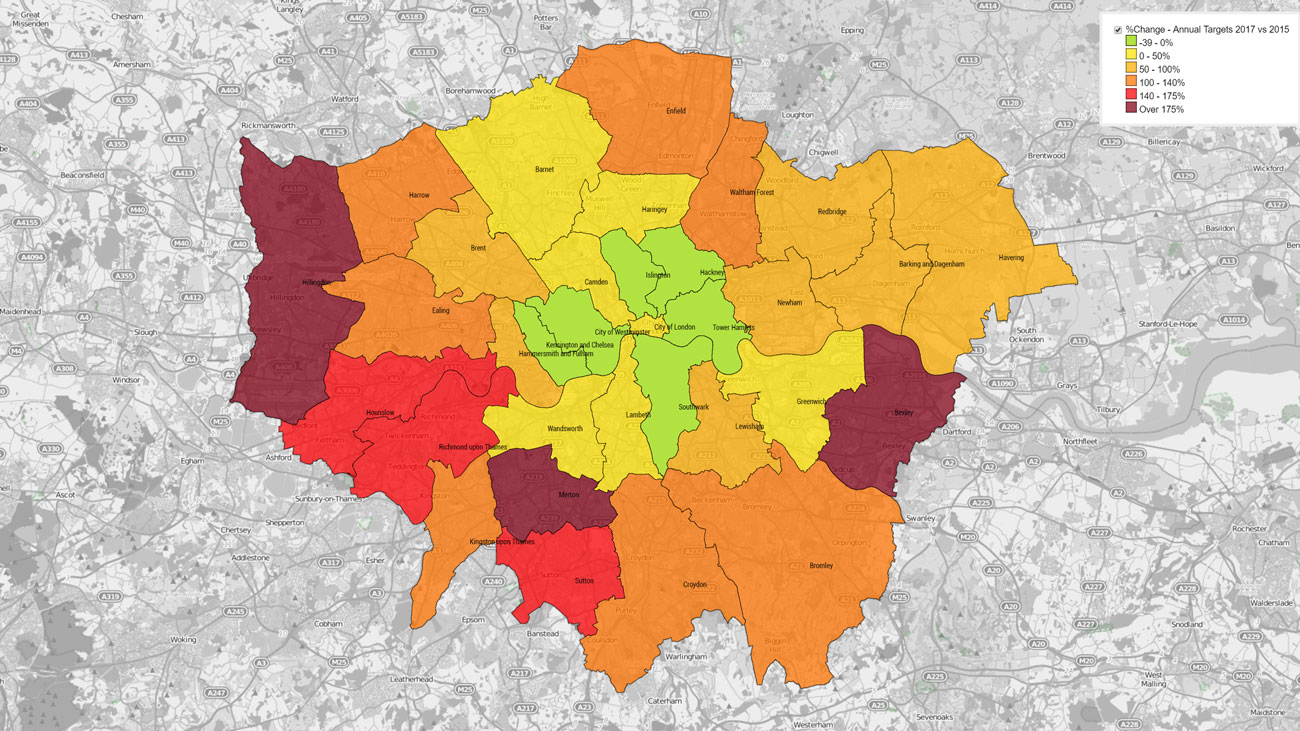
% Change between 2017 vs 2015 targets
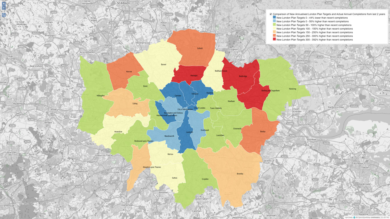
Comparison of New Annualised London Plan Targets and the Average of Actual Annual Completions in 2014/15 and 2015/16
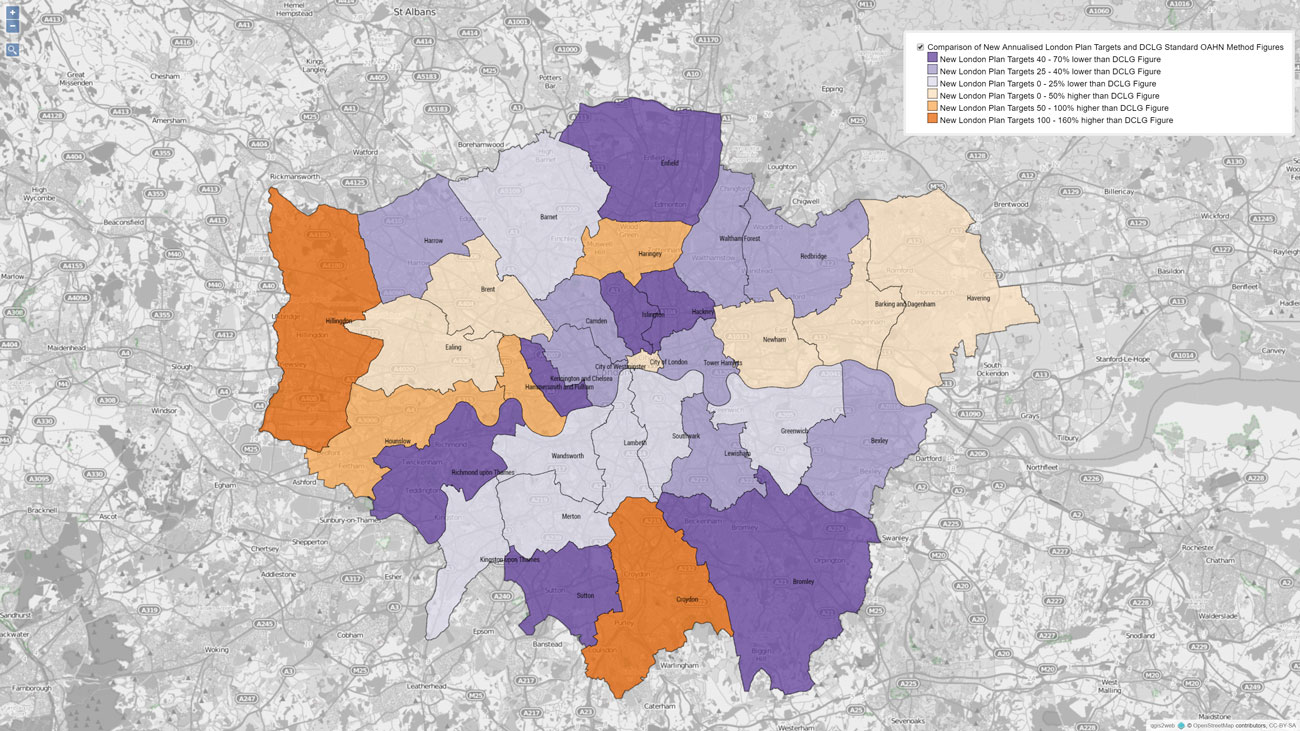
Comparison of New Annualised London Plan Targets and DCLG Standard OAHN Method Figures
Data Table – Sources: GLA AMRs and OS Open Data
Please contact us
We can provide mapping data across England or for individual local authorities, cities, towns and villages / parishes. If you are a developer interested in our maps we can provide you with access to particular local authorities. Call us today: 0207 0961329
For more info, please contact Troy Hayes: thayes@troyplanning.com
