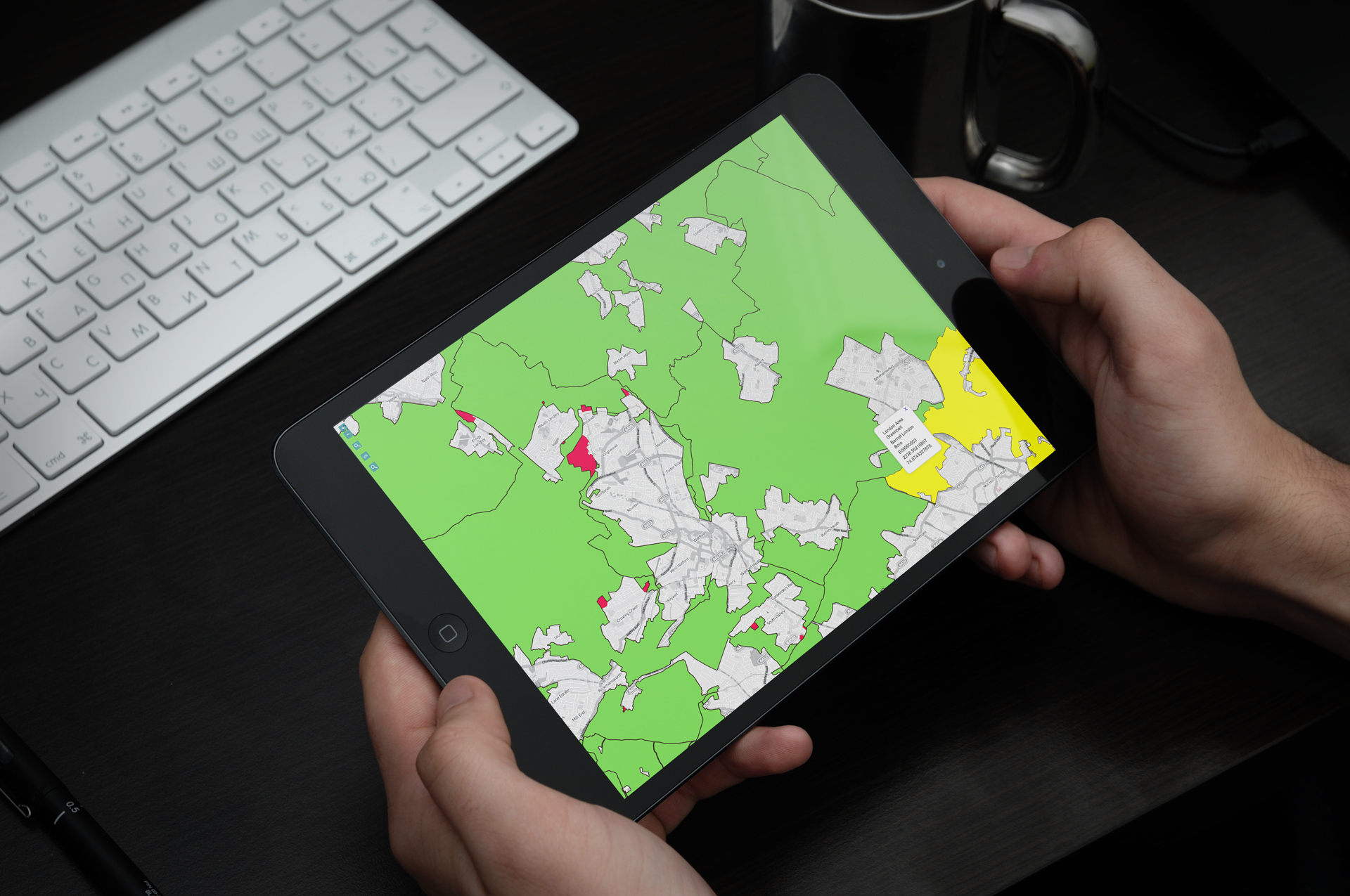
We’ve created an interactive map of the full extent of the Green Belt in England which allows you to compare the Green Belt in 2017 and 2020.
We’ve used open data provided by Ordnance Survey and MHCLG.
See what Green Belt has been released and in a few instances what Green Belt has been added:
Interactive Green BeltThis is one of the maps we will use to communicate England’s changing Green Belt as local authorities review the extent of their Green Belts through their local plans and through planning decisions.